
Some of the numbers presented in this website may not be the most recent available
Globalshift.co.uk - copyright © 2009 to 2025; All rights reserved


AUSTRALASIA
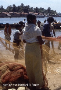
Sorting fishing nets
Brief history of the country
Palau (the Republic of Palau) is located east of the Philippines and north of Indonesia. It is the western chain of the Caroline Islands of Micronesia and comprises roughly 250 islands.
The islands were probably first settled around 3,000 years ago by migrants from the Philippines. Negritos (Pygmys) lived there until 1100 AD when people from the Sunda islands took over.
Some of the islands were sighted by Europeans in 1522 and, after Spain conquered the Philippines in 1565, Palau became part of the Spanish East Indies. However they were left alone until 1697 when Jesuits began to visit and the Spanish and British began to trade.
In 1899 defeat in the Spanish–American War forced Spain to sell most of the Caroline Islands to Germany. In 1914, during World War 1, Japan annexed the archipelago and, after the war, administered it within the South Pacific Mandate.
In 1944 the USA captured the islands and took the mandate in 1947. Having voted against joining the Federated States of Micronesia in 1979, Palau opted for independent status, becoming a republic in 1981 and gaining sovereignty in 1994 in association with the USA.
The economy is based on tourism, agriculture and fishing. The islands are a financial centre but also depend on foreign aid.
Oil and gas summary
Palau is an archipelago of around 250 islands. Most of the population live on just 5 (Angaur, Babeldaob, Koror, Peleliu and Kayangel) of which two-thirds live on Koror.
Babeldaob is by far the largest and is primarily volcanic. All the other islands are remnants of a large coral reef on a volcanic ridge (Kyushu Palau) with varying amounts of fringing limestone reefs.
These mostly comprise 200 uninhabited islands to the west known as the Rock Islands but also a remote group of 6 islands, known as the Southwest Islands, which lie 604 kms to the southwest.
The archipelago lies on the Kyushu Palau ridge which is an uplifted part of the Philippines tectonic plate. Tectonically the islands are the remains of an island arc that initially developed in the Eocene in response to subduction to the west in the Ryuku trench, the collision boundary of the Philippine tectonic plate subducting below the Eurasian plate.
Palau has no history of drilling and production and no exploration wells have ever been drilled on any of the islands or in their surrounding waters. Globalshift believes the islands and surrounding waters have no oil and gas potential.

PALAU
Map and National Flag

Australasia


Capital
Population
Land area (sq kms)
Oil prod (000s b/d)
Gas prod (bcm/yr)
Oil cons (000s b/d)
Gas cons (bcm/yr)
Ngerulmud
0.02 mm
459
None
None
0.21
None
Government
Palau is a democratic republic. The President is both head of state and head of government.
Executive power is exercised by the government, while legislative power is vested in both the government and the bicameral Palau National Congress.
The Senate has nine elected members and the House of Delegates 16 elected members. The USA provides defence, funding, and social services.
There is no department of government in Palau specifically responsible for oil and gas resources.